![](/images/other/stat-length.png)
Un panorama sur la faune
jyv
User
![Length](/images/other/stat-length.png)
Length
18.4 km
![Max alt](https://static1.geolcdn.com/siteimages/upload/files/1508320355ic_sort_altitude_max_24dp.png)
Max alt
63 m
![Uphill gradient](https://static1.geolcdn.com/siteimages/upload/files/1508320355ic_sort_den_pos_24dp.png)
Uphill gradient
179 m
![Km-Effort](/images/other/stat-length.png)
Km-Effort
21 km
![Min alt](https://static1.geolcdn.com/siteimages/upload/files/1508320355ic_sort_altitude_min_24dp.png)
Min alt
18 m
![Downhill gradient](https://static1.geolcdn.com/siteimages/upload/files/1508320355ic_sort_den_neg_24dp.png)
Downhill gradient
180 m
![Boucle](https://static1.geolcdn.com/siteimages/upload/files/16400158638029165_repeat_loop_refresh_sync_direction_icon.png)
Boucle
Yes
Creation date :
2014-12-10 00:00:00.0
Updated on :
2014-12-10 00:00:00.0
![Cycle](https://static1.geolcdn.com/sitytour/trail-icons/200.png)
--
Difficulty : Easy
![Scan this QR Code to open this trail in the SityTrail application](https://capi.geolives.com/qq0zvz2zws4bq2lad0pu/sitytour/trails/65547/qr.png?size=200)
FREE GPS app for hiking
About
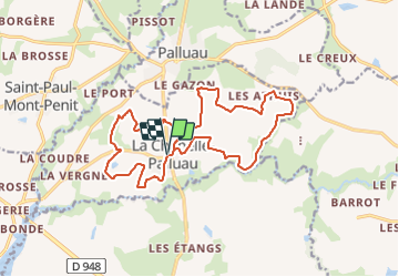
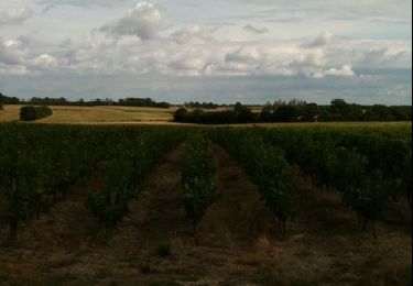
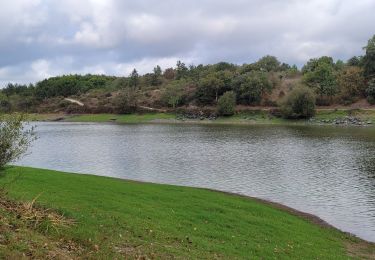
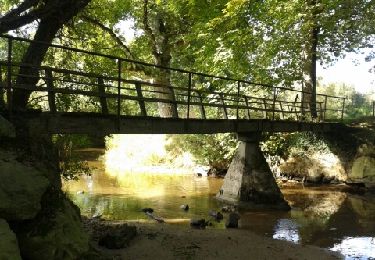
Trail Cycle of 18.4 km to be discovered at Pays de la Loire, Vendée, La Chapelle-Palluau. This trail is proposed by jyv.
Description
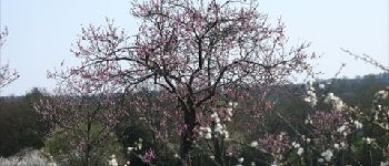
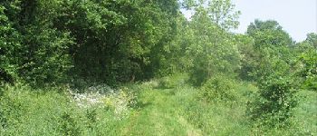
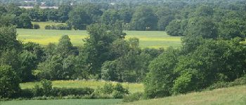
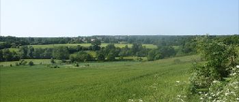
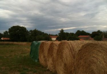
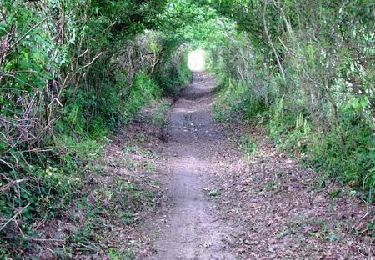
Vue panoramique et immersion dans la nature. Autour de la Borderie de la Marchaizière venez à la rencontre des petits animaux de la campagne qu'il n'est pas rare de croiser. Balade nature en vélo.
Positioning
Country:
France
Region :
Pays de la Loire
Department/Province :
Vendée
Municipality :
La Chapelle-Palluau
Location:
Unknown
Start:(Dec)
Start:(UTM)
605117 ; 5182097 (30T) N.
Comments
Trails nearby
![Trail Mountain bike Saint-Étienne-du-Bois - Circuit nature au départ de la Borderie de la Marchaizière - Photo](https://media.geolcdn.com/t/375/260/ext.jpg?maxdim=2&url=https%3A%2F%2Fservices.sitytrail.com%2FGeolivesWS%2FDownloadMedia.ashx%3FTrailID%3D106272%26Media%3D10627_6.jpg)
![Mountain bike Mountain bike](https://static1.geolcdn.com/sitytour/trail-icons/202.png)
Circuit nature au départ de la Borderie de la Marchaizière
Mountain bike
Medium
Saint-Étienne-du-Bois,
Pays de la Loire,
Vendée,
France
![](/images/other/stat-length.png)
14.5 km | 16.4 km-effort
2h 0min
![](https://static1.geolcdn.com/siteimages/upload/files/16400158638029165_repeat_loop_refresh_sync_direction_icon.png)
Yes
![Trail Running Le Poiré-sur-Vie - Le Poiré Sur Vie - Sentier de la Vie - Photo](https://media.geolcdn.com/t/375/260/ext.jpg?maxdim=2&url=https%3A%2F%2Fservices.sitytrail.com%2FGeolivesWS%2FDownloadMedia.ashx%3FTrailID%3D101033%26Media%3D524_5.jpg)
![Running Running](https://static1.geolcdn.com/sitytour/trail-icons/103.png)
Le Poiré Sur Vie - Sentier de la Vie
Running
Medium
Le Poiré-sur-Vie,
Pays de la Loire,
Vendée,
France
![](/images/other/stat-length.png)
12.4 km | 14.4 km-effort
1h 10min
![](https://static1.geolcdn.com/siteimages/upload/files/16400158638029165_repeat_loop_refresh_sync_direction_icon.png)
No
![Trail Mountain bike Le Poiré-sur-Vie - Le Poiré Sur Vie - Sentier de la Vie - Photo](https://media.geolcdn.com/t/375/260/ext.jpg?maxdim=2&url=https%3A%2F%2Fservices.sitytrail.com%2FGeolivesWS%2FDownloadMedia.ashx%3FTrailID%3D101032%26Media%3D524_5.jpg)
![Mountain bike Mountain bike](https://static1.geolcdn.com/sitytour/trail-icons/202.png)
Le Poiré Sur Vie - Sentier de la Vie
Mountain bike
Medium
Le Poiré-sur-Vie,
Pays de la Loire,
Vendée,
France
![](/images/other/stat-length.png)
12.4 km | 14.4 km-effort
45min
![](https://static1.geolcdn.com/siteimages/upload/files/16400158638029165_repeat_loop_refresh_sync_direction_icon.png)
No
![Trail Walking Le Poiré-sur-Vie - Le Poiré Sur Vie - Sentier de la Vie - Photo](https://media.geolcdn.com/t/375/260/ext.jpg?maxdim=2&url=https%3A%2F%2Fservices.sitytrail.com%2FGeolivesWS%2FDownloadMedia.ashx%3FTrailID%3D101031%26Media%3D524_5.jpg)
![Walking Walking](https://static1.geolcdn.com/sitytour/trail-icons/101.png)
Le Poiré Sur Vie - Sentier de la Vie
Walking
Medium
Le Poiré-sur-Vie,
Pays de la Loire,
Vendée,
France
![](/images/other/stat-length.png)
12.4 km | 14.4 km-effort
2h 10min
![](https://static1.geolcdn.com/siteimages/upload/files/16400158638029165_repeat_loop_refresh_sync_direction_icon.png)
No
![Trail Cycle Saint-Étienne-du-Bois - Entre nature et culture - Photo](https://media.geolcdn.com/t/375/260/ext.jpg?maxdim=2&url=https%3A%2F%2Fservices.sitytrail.com%2FGeolivesWS%2FDownloadMedia.ashx%3FTrailID%3D49517%26Media%3D20110308113927.jpg)
![Cycle Cycle](https://static1.geolcdn.com/sitytour/trail-icons/200.png)
Entre nature et culture
Cycle
Medium
Saint-Étienne-du-Bois,
Pays de la Loire,
Vendée,
France
![](/images/other/stat-length.png)
22 km | 25 km-effort
Unknown
![](https://static1.geolcdn.com/siteimages/upload/files/16400158638029165_repeat_loop_refresh_sync_direction_icon.png)
Yes
![Trail Cycle Saint-Étienne-du-Bois - Vous aimez la nature ? Partez la découvrir ...Au départ de la Borderie - Photo](https://media.geolcdn.com/t/375/260/ext.jpg?maxdim=2&url=https%3A%2F%2Fservices.sitytrail.com%2FGeolivesWS%2FDownloadMedia.ashx%3FTrailID%3D44140%26Media%3Dimage15.jpg)
![Cycle Cycle](https://static1.geolcdn.com/sitytour/trail-icons/200.png)
Vous aimez la nature ? Partez la découvrir ...Au départ de la Borderie
Cycle
Very easy
Saint-Étienne-du-Bois,
Pays de la Loire,
Vendée,
France
![](/images/other/stat-length.png)
14.7 km | 16.5 km-effort
42min
![](https://static1.geolcdn.com/siteimages/upload/files/16400158638029165_repeat_loop_refresh_sync_direction_icon.png)
Yes
![Trail Mountain bike Maché - les lacs vendee - Photo](https://media.geolcdn.com/t/375/260/81364511-79be-4e7c-b17c-b758339a4c50.jpg&format=jpg&maxdim=2)
![Mountain bike Mountain bike](https://static1.geolcdn.com/sitytour/trail-icons/202.png)
les lacs vendee
Mountain bike
Difficult
Maché,
Pays de la Loire,
Vendée,
France
![](/images/other/stat-length.png)
34 km | 38 km-effort
2h 12min
![](https://static1.geolcdn.com/siteimages/upload/files/16400158638029165_repeat_loop_refresh_sync_direction_icon.png)
Yes
![Trail Mountain bike Aizenay - Aizenay 2024 - Photo](https://media.geolcdn.com/t/375/260/ext.jpg?maxdim=2&url=https%3A%2F%2Fstatic1.geolcdn.com%2Fsiteimages%2Fupload%2Ffiles%2F1524743154velo.jpg)
![Mountain bike Mountain bike](https://static1.geolcdn.com/sitytour/trail-icons/202.png)
Aizenay 2024
Mountain bike
Medium
Aizenay,
Pays de la Loire,
Vendée,
France
![](/images/other/stat-length.png)
35 km | 39 km-effort
2h 44min
![](https://static1.geolcdn.com/siteimages/upload/files/16400158638029165_repeat_loop_refresh_sync_direction_icon.png)
Yes
![Trail Walking Le Poiré-sur-Vie - La Jaunière - Photo](https://media.geolcdn.com/t/375/260/ext.jpg?maxdim=2&url=https%3A%2F%2Fservices.sitytrail.com%2FGeolivesWS%2FDownloadMedia.ashx%3FTrailID%3D225731%26Media%3D4a1a43b7-a886-435e-a9b6-fed23030a177.jpg)
![Walking Walking](https://static1.geolcdn.com/sitytour/trail-icons/101.png)
La Jaunière
Walking
Easy
Le Poiré-sur-Vie,
Pays de la Loire,
Vendée,
France
![](/images/other/stat-length.png)
10.6 km | 12.5 km-effort
3h 0min
![](https://static1.geolcdn.com/siteimages/upload/files/16400158638029165_repeat_loop_refresh_sync_direction_icon.png)
Yes